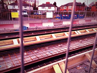
The tram tracks are now being laid down the centre of Hardy Lane. Slowly the construction of the line to connect the airport with the centre of Manchester is coming along. I'm recording the progress with photographs.
As Hardy Lane is not a busy thoroughfare for cars reducing the road to single line traffic shouldn't cause any long tail backs. However the siting of the station at the junction of Mauldeth Road West and Barlow Moor Road might isn't ideal. Not ideal for foot passengers who will have to cross two main roads to reach the platforms. You have a similar situation in Droylsden and there are no cycle lanes to contend with there.
The picture below is from the Manchester Libraries Archives. It shews the tram times to reach the centre of town from the outlying districts in 1917.
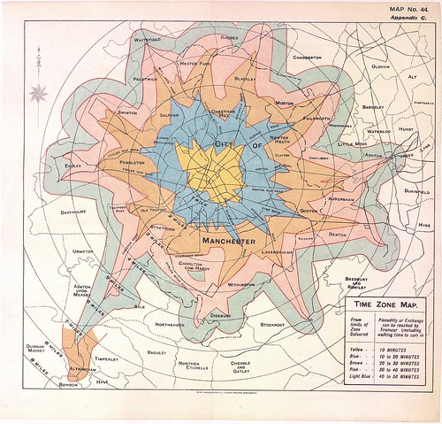
Depending on which part of Chorlton-cum-Hardy you lived in it could take from between 20 minutes to 50 minutes to arrive at Piccadilly. It is maybe marginally faster on the Metrolink these days but then you have to factor in the time to walk to the station.
No comments:
Post a Comment